The Landscape of the Piedmont
Kennesaw Mountain, Marietta, Cobb County, Georgia

For the story of Kennesaw Mountain's geology, click here.
Civil War History
Kennesaw Mountain has been set aside as a National Battlefield Park for the horrific Civil War battles that took place here from June 19 to July 2, 1864 resulting in 5,350 dead. The relentless march of General William Tecumseh Sherman and his Union soldiers met with a valiant last-ditch effort of General Joseph Eggleston Johnston and his Confederate troops as they tried to keep Atlanta from being overtaken. The commanding height of Big Kennesaw (1,808 feet above sea level and 900 feet above the surrounding Piedmont) offered a vantage point for the Confederate Army to watch the advance of the Union Troops from well entrenched and protected positions. Sherman boldly attacked the Confederate troops on the mountain at 8 a.m on June 27 with a massive frontal assault, something he normally avoided. The artillery attack was so ferocious that Lt. Col. Joseph S. Fullerton wrote, "Kennesaw smoked and blazed with fire, a volcano as grand as Etna."
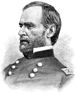
General William Tecumseh Sherman (1820-1891) In the Public Domain
|
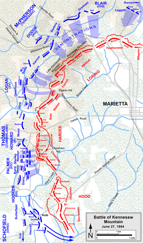
Map by Hal Jespersen, www.posix.com/CW
Click on map to enlarge.
|
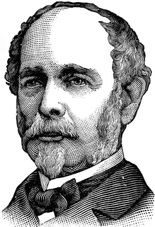
General Joseph Eggleston Johnston (1807-1891) In the Public Domain
|

|
Casualties were enormous with some 3,000 Union and 1,000 Confederates dead. While many consider the battle a win for the Confederacy, Sherman's troops continued onward to battle at Peachtree Creek and then took Atlanta and burned it to the ground. From the ashes of Atlanta he began his March to the Sea on November 16 that ended with the capture of the port of Savannah on December 21.
Sherman truly believed the war would only end with a Biblical "utter destruction" [Deuteronomy 20:17] of the Confederacy to the point that not only its infrastructure, but its very will to survive would be destroyed. On the march not only were buildings and railroad demolished, but crops were burned and store supplies taken and eaten. and Wounds from his unrelenting destruction of the fabric of the South's infrastructure gave serious meaning to the word "reconstruction" that followed the Civil War. These wounds went so deep that to this day in many quarters the name Sherman is despised. |
|
After the war, harvests from crops plummeted to levels that could not support the population and housing was severely limited. Many refugees found there way to Atlanta and the population began to grow and along with it a new city.
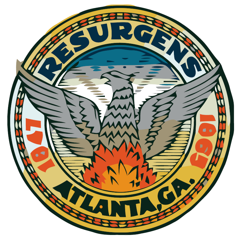
Since the City of Atlanta grew from the ashes of the Civil War, its motto is resurgens and its symbol the Phoenix as the city resurrected from the ashes and a new bird took to the air and the city now is the capital of the south. |
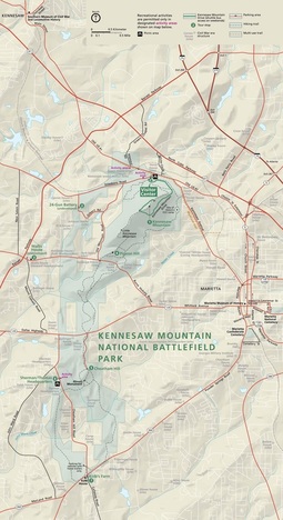
Click map to go to link to download this map.
|
The Landscape
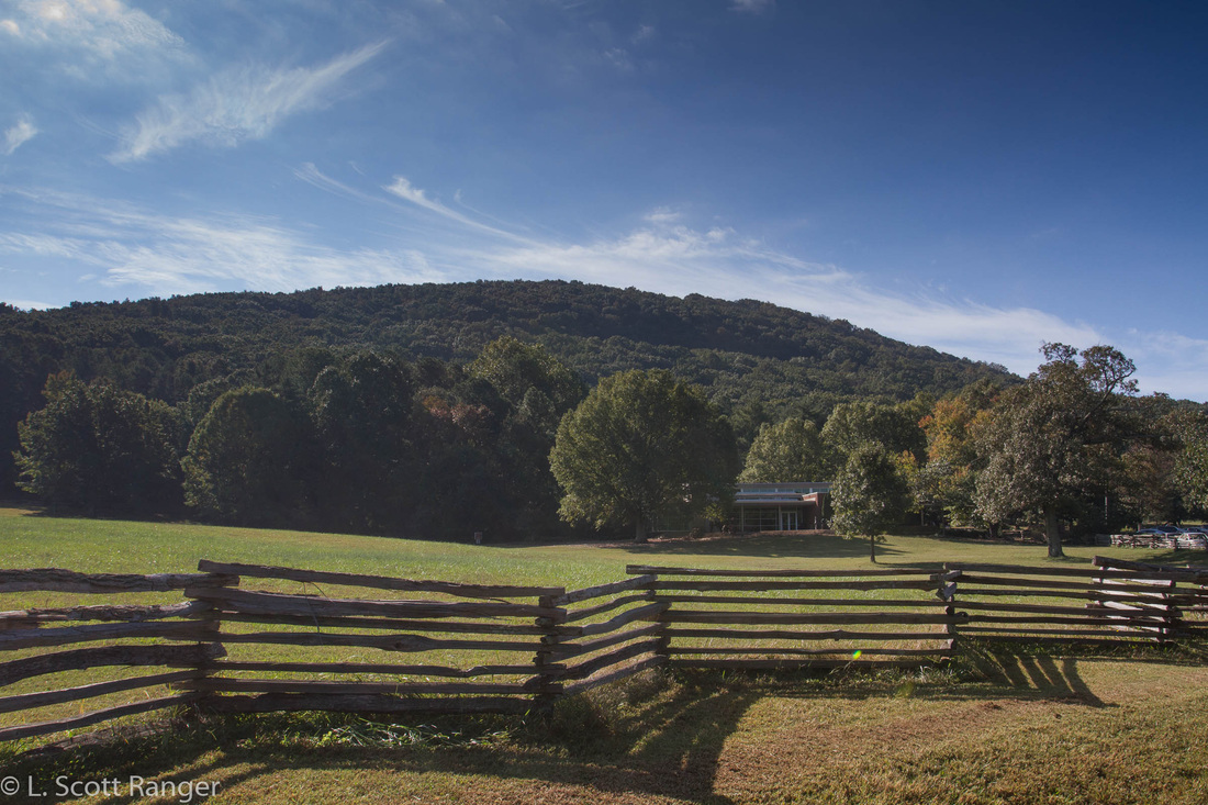
Today, the 2,923 acre park is far more than a memorial to a major battle near the end of the Civil War. It is now a significant island of green in a vast area of urban sprawl, being protected as parkland since 1917. Kennesaw Mountain is a major geographic feature of the northwest Atlanta metropolitan area, one of several monadnocks that rise above the Piedmont. The small mount of Lost Mountain can be seen near the horizon of the banner photo. The mountain is a dominating presence as it rises some 900 feet above the Piedmont peneplain with its average elevation about 900 feet to an elevation of 1,808 feet above sea level. It forms a ridge just under two miles long that runs a northeast-southwest line. Big Kennesaw Mountain forms the higher of two summits, with Little Kennesaw Mountain reaching an elevation of 1600 feet above sea level. Pigeon Hill at the extreme southwest end of the ridge rises 1,240 feet above sea level. The slopes are steep—up to a 45% slope—with numerous outcrops of rock faces and boulders, yet other than the bare rock and adjacent areas, the mountain is entirely forested. It has been designated an Important Bird Area by the Audubon Society as impressive numbers of birds stop here on their migrations north and south. It has become "the" place in Georgia to spot Cerulean Warblers. I've been wandering Kennesaw Mountain for more than three decades. During the 1980's I began a personal survey of the mountains flora and have self-published a checklist of the plants of the mountain.
| ||
The origin of the name Kennesaw is confused. The most reputable source is Kenneth K. Krakow's Georgia Place Names: their history and origins where he notes "The mountain was named by the Indians, and is possibly a variation of Conasauga, the name of an Indian town that was located nearby. Reverend George White believed the place was named for an old Indian chief by the name of Kennesaw who signed the Treaty of Holston in 1791". There persists in many unsupported references that it is a corruption of the Cherokee "Gah-nee-sah" for place of the dead. Consulting several Cherokee dictionaries, none have anything resembling gah-nee-sah for cemetery, place, dead, burial, or burial ground. The National Park Service removed this from their website in 2013, the source used by many for the origin of the name. The Geographic Names Information System gives no origin but notes the name was officially accepted in 1911.