The Juneau Icefield
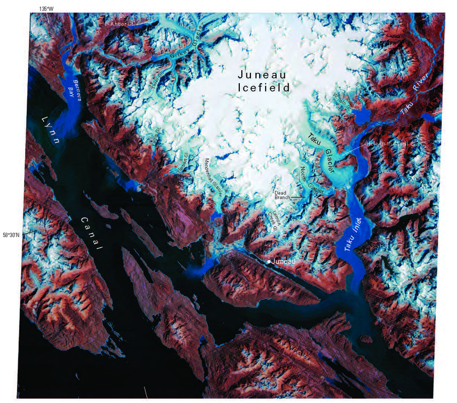
Figure 86.—Annotated Landsat 5 TM quarter-scene, false-color composite image acquired on 9 September 1984 of the Coast Mountains from east of the Taku River to west of Berners Bay. Outlet glaciers from the Juneau Icefield include the Twin, Hole-in-the-Wall, Taku, Norris, Lemon Creek, Mendenhall, Herbert, Eagle, Gilkey, and Bucher Glaciers. Approximate scale 1:500,000. Landsat image L5057019008425350 is courtesy of Robert M. Krimmel, U.S. Geological Survey, and is from the USGS, EROS Data Center, Sioux Falls, S. Dak.
Molnia, B. 2008. Glaciers of North America-Glaciers of Alaska, in Williams, R.S. & J.G. Ferrigno, eds. 2008. Satellite Image Atlas of Glaciers of the World: Alaska. U.S. Geological Survey Professional Paper 1386–K.
The Juneau Icefield covers an area of 1,500 square miles which is about the same size as the state of Rhode Island. In places the ice is nearly 5,000 feet deep, but it averages about 1,000. The only larger icefield in North America is the Malaspina-St. Elias icefield. Snowfall exceeding 100 feet annually has been measured by the Juneau Icefield Research Program. Snow has been falling in massive amounts here for some 3,000 years with the Little Ice Age.
Definitions:
Icefield: A large, up to 50,000 km² (19,305 mile²) area where vast amounts of snow collect and compress under its own weight into ice. Icefields are constrained by topography and usually have interconnected valleys and basins that fill with ice and low places where the ice flows out as glaciers.
Glacier: A large, perennial accumulation of ice, snow, rock, sediment and liquid water originating on land and moving down slope under the influence of its own weight and gravity; a dynamic river of ice. (Molnia, 2008)
firn: Rounded, well-bonded snow that is older than one year; firn has a density greater than 550 kilograms per cubic-meter (35 pounds per cubic-foot); called névé during the first year. (National Snow and Ice Data Center, 2014)
For more information on glaciers, visit the National Snow and Ice Data Center.